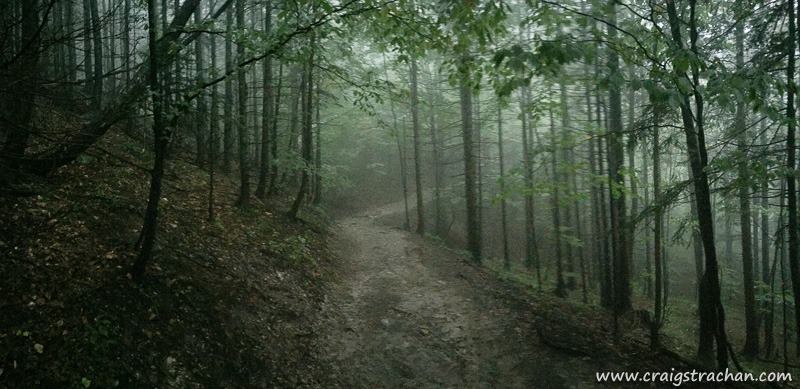
I left you on the Tatra mountains, roughly halfway between Zakopane and the Slovakia border. I was soaking wet, and running on some very water-logged trails, and having loads of fun. The flat, wide and dry touristy trails turned into waterlogged impromptu rivers, and these finally turned into firm earthy single-track trails.

While I ran through the forest, I could smell a wonderful wet and earthy decay. That wonderful smell of nature composting dead branches and leaves back into earth from which new trees will grow. It was misty weather, so everything had a slightly mystical nature. I felt like I was running in one of the many fantasy novels that I have read.

The view from the top was spectacular. I had finally run above the forest, so I could look down at the trees. I couldn’t see much besides the tops of the trees just in front of me, but it felt liberating to stand there, having run all the way to the top.
When I say “to the top”, I was only about 1/2 way to Slovakia; I had already climbed over 500m in about 7km, and that was the easy part of the trail. I very much doubt you would be able to run the second half to Slovakia. It would be a very tough hike.
Here is the route I took if you want to see it. https://www.strava.com/activities/702351830
Some quick notes on safety.
- I had the Tatra mountain rescue number in my phone. For reference it is +48 601 100 300
- I pre-loaded my route into my GPS watch, and my wife had a copy of my route
- I took water & some food with me
- I took a space blanket, first aid kit, compass, mountain maps, windbreaker & gloves with me
- I make sure Lois know my expected arrival time, and gave her a suggested window before she worry
- My phone was fully charged
Hi Craig
Thank you for the fine report of your trip to Zakopane. Our summerholiday goes to Tatra in Poland this year and we expect to take a couple of runningtrips in the Tatra Mountains.
Did you make your route yourself, or did you find the routes somewhere to download?
Many trail greetings from Denmark,
Jacob
I created the route myself using Strava’s route builder, and then I checked it against a printed map (at the tourist office in Zakopane you can buy an excellent hiking map).
The mountain seems to be roughly divided into three levels. The first is wide and very easy to run or walk (lots of families walk there). The second section is single track with some technical sections. The third will take you to the top – I didn’t run that high but I’m sure it will be mostly walking.
Of course I took the usual kit (water, space blanket, compass, printed map etc). Tatra mountain rescue: +48 601 100 300?
Here’s my run: https://www.strava.com/activities/702351830
I’m running there again in June this year.